Okinawa Peace Memorial Park (Photo by Steph Pawelski)
All throughout Okinawa you’ll find remnants of the Battle of Okinawa, a major World War II campaign fought over the course of three months in 1945.
Today, many battle sites have become parks and museums. Some have many-in-one attractions for the whole family to enjoy, including playgrounds and picnic areas intermixed with battle-related sites, others are in Naha and surrounded by city life and adventures.
As always, be careful! Okinawa is home to a variety of poisonous snakes, spiders, and insects.
1. United States Landing Beaches
The Americans landed on Okinawa’s central west coast to begin the battle for Okinawa. The U.S. Marines landed to the north at Toguchi Beach, Yomitan. Four miles south, in Sunabe Baba Park, Chatan is a landing monument for the U.S. Army.
Today, Toguchi Beach and Sunabe Baba Park have picturesque ocean-front parks. The coastal water can be calm and shallow during low tide, but precautions still need to be made when exploring these areas.
Toguchi Beach - landing monument (U.S. Marine Corps). (Photo by Steph Pawelski)
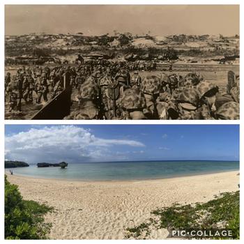
Top: “MARINES LANDED ON OKINAWA AGAINST MILD RESISTANCE”.
Photo and Caption Credit: US Archives
Bottom: Present day: Toguchi Beach, Yomitan Comparison (photo by Steph Pawelski) ()
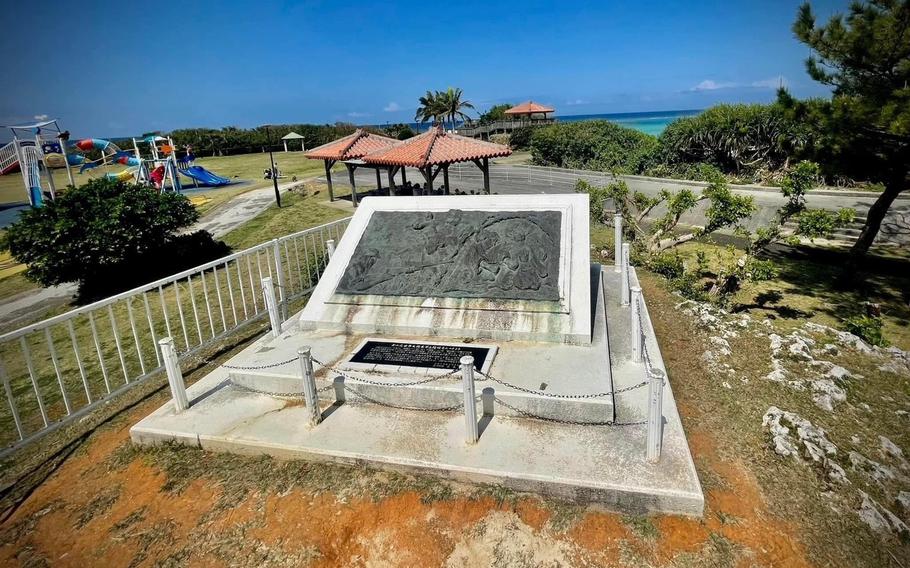
Chatan Landing (Photo by Steph Pawelski)
Toguchi Beach, Yomitan - World War II U.S. Military Landing Monument
GPS (monument) 26.3634965, 127.7393802
GPS (parking): 26.3642484, 127.7386859
Chatan Beach - World War II US Army Landing Monument
GPS: 26.3339899, 127.7454675 (monument)
GPS (parking): 26.3334139, 127.7453981
2. Kakazu Ridge
The hilly area known as Kakazu Ridge is 7.5 miles south of the U.S. Army Landing Monument. The fight for this ridge began on April 9, 1945, and continued for about two weeks until the Japanese abandoned this area and withdrew less than a mile south to Hacksaw Ridge, according to an Urasoe City guide on area battle sites.
Kakazu Ridge was the first of Japan’s numerous outer defense positions, called the Shuri Defense Zone created to protect the Shuri Castle. It was here that Lt. General Mitsuru Ushijima, Commander of the Japanese Forces on Okinawa, stayed for most of the battle. According to an article titled “Shuri Castle and Japanese Castles: A Controversial Heritage,” the headquarters’ location, close to Shuri Castle, ultimately made the castle a target for the Americans.
These days, Kakazutakadai Park is a beautiful outdoor attraction with a great picnic area and a newer playground. This area is well-maintained, and several battle-related sites include an observation deck, a pill box, an underground bunker, and a portion of a wall with bullet damage. All these sites saw action during the fight for Kakazu Ridge.
Kakazu Ridge (Photo by Steph Pawelski)
Kakazu Ridge
GPS (parking): 26.2580599, 127.7367010
Climb the staircase and follow the posted signs to each site.
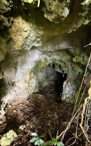
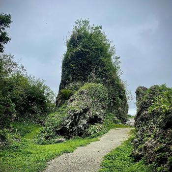
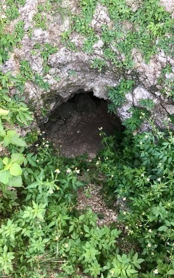
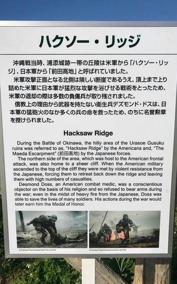
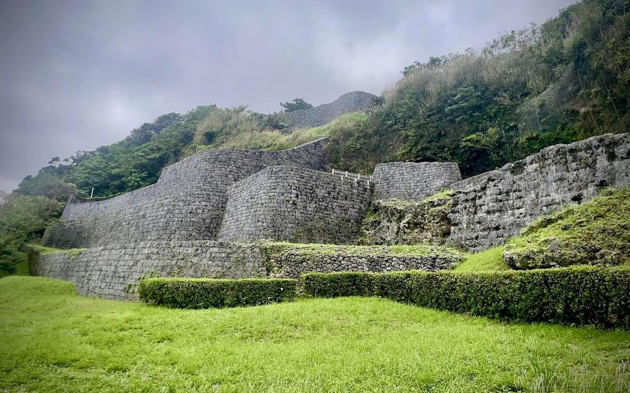
3. Hacksaw Ridge
Hacksaw Ridge is one the most important battlefields during the Battle of Okinawa.
After the United States gained control of Kakazu Ridge, it marked the fall of the first Shuri Defense Zone, according to the book “Okinawa: The Last Battle - United States Army in World War II, The War in the Pacific.” The Japanese military then withdrew to Hacksaw Ridge to defend the second ring of protection for the Japanese headquarters. By May 6, the book details, Hacksaw Ridge was captured by the U.S. military, marking the fall to the second Shuri Defense Zone.
Each site along Hacksaw Ridge is more than just a location, it’s a piece of history. Exploring the ridge, enjoying nature, and appreciating the views from the top gains a deeper understanding of the events that happened here.
Hacksaw Ridge (Photo by Steph Pawelski)
Hacksaw Ridge (Photo by Steph Pawelski)
Hacksaw Ridge (Photo by Steph Pawelski)
Hacksaw Ridge (Photo by Steph Pawelski)
Hacksaw Ridge (Needle Rock) (Photo by Steph Pawelski)
GPS (parking): 26.2454012, 127.7299241
For Desmond Doss point:
This spot is named after Desmond Doss, a combat medic who refused to carry a weapon due to his religious beliefs and saved the lives of many troops while still under enemy fire. A signboard here describes Doss and his actions during the battle which led to a Medal of Honor, as well as how American troops were killed or wounded when attempting to retreat at this very spot.
GPS: 26.2467418, 127.7323642
Needle Rock – This 42.7 foot-tall rock marks the U.S. military’s approach there as described in a previous Stripes Okinawa article.
GPS: 26.2452551, 127.7342552
Kanpan Underground Position – According to a signboard at this location, this tunnel that was used to store food and medical supplies for the Japanese military.
GPS: 26.2453002, 127.7324383
4. Sugar Loaf Hill
From Hacksaw Ridge, hop back in your car and drive three miles southwest to Sugar Loaf Hill. The fight for Sugar Loaf Hill began on May 12, 1945. Sugar Loaf was a strong defensive position designed to protect the 32nd Japanese Imperial Army’s Headquarters, about a mile away. A signboard on top of the hill reads: “The Americans prevailed on May 18, with 2,662 casualties, and another 1,289 suffered battle fatigue.”
There is also a monument and an observation tower near the signboard and can be viewed by the public.
TeamLab Future Park Okinawa, a popular interactive digital art experience for children, is across the street.
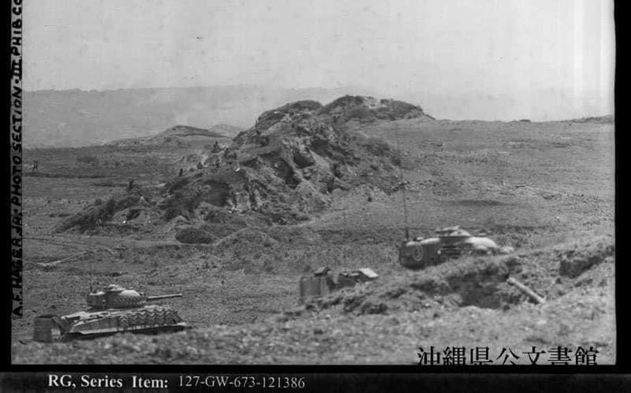
Marines pinned down on ridge approaching “Sugar Loaf” Hill. (Photo and Caption Credit: Okinawa Prefectural Archives)
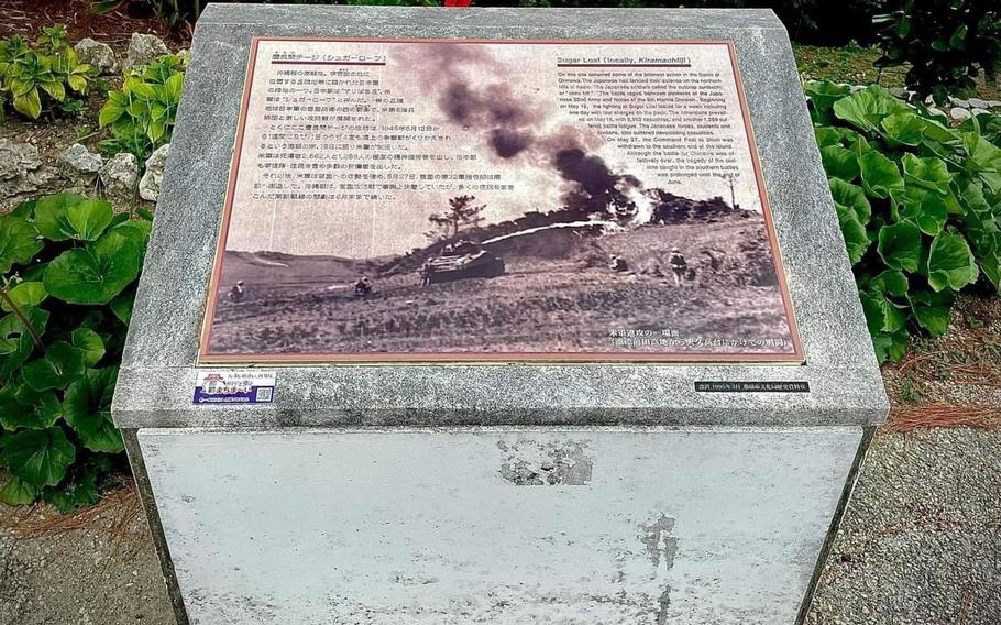
The signboard at Sugar Loaf Hill describes the fight there on where over 2,662 lost their lives. (Photo by Steph Pawelski)
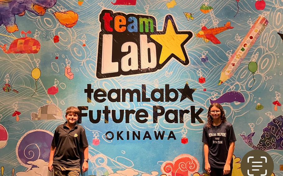
My kids, William, 12 and Hannah, 14 at teamLab Future Park Okinawa across from Sugar Loaf Hill (Photo by Steph Pawelski)
GPS (parking): Must find appropriate parking
GPS (Sugar Loaf Hill): 26.2226300, 127.6959140
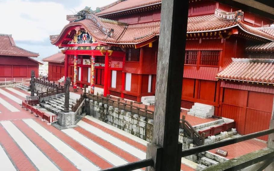
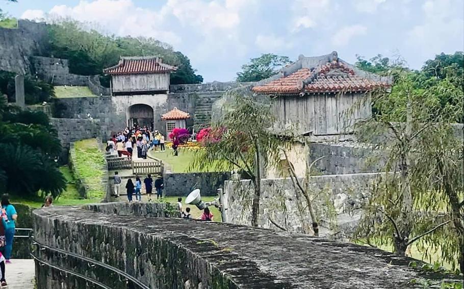
5. Japanese Imperial Army Headquarters (Shuri Castle)
The former Japanese Imperial Army Headquarters is located on the premises of the Shuri Castle, two miles east from Sugar Loaf Hill. A pamphlet from the Center for the Tokyo Raids and War Damage details how the hill was used by the 32nd Japanese Imperial Army’s headquarters and was the living quarters for Lt. Gen. Ushijima, commander of the Japanese forces at the time. By the end of May, the defenses around the castle were weak, most areas were deserted. The U.S. only experienced minor confrontations. The perimeter was surrounded, the high grounds were occupied, and U.S. troops entered the castle.
Shuri Castle is one of Okinawa’s most familiar buildings and a UNESCO World Heritage Site. It has a long and devoted history and is a must-see stop for every tourist. It is one of the highest points on the island and the view from here is fantastic.
Shuri Castle is one of Okinawa’s most familiar buildings and a UNESCO World Heritage Site. (Photo by Steph Pawelski)
Shuri Castle is one of Okinawa’s most familiar buildings and a UNESCO World Heritage Site. (Photo by Steph Pawelski)
The former Japanese Imperial Army Headquarters is located on the premises of the Shuri Castle, two miles east from Sugar Loaf Hill. (Photo by Steph Pawelski)
GPS (parking): Must find appropriate parking
GPS (headquarters): 26.2182709, 127.7178877
6. Kibogaoka Park
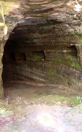
Heading two miles west of the Shuri Castle are several tunnel entrances around the base of the park used, they are now closed to the public. Today, it is a recreational park run by the City of Naha with a fun playground and a tug-of-war air museum.
Kibogaoka Park (Photo by Steph Pawelski)
Kibogaoka Park is a recreational park run by the City of Naha with a fun playground and a tug-of-war air museum. (Photo by Steph Pawelski)
GPS (parking): Must find appropriate parking
GPS (park): 26.2154946, 127.6895143
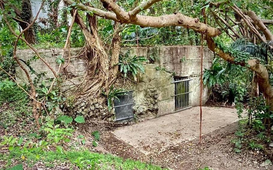
7. Tabaru Park, Navy Underground Headquarters
Continuing your journey, take an unforgettable trip through downtown Naha for about two-and-a-half miles to Tabaru Park. There is a playground, a cement slide, and a beautiful area to picnic. It’s a great place to spend an afternoon.
Tabaru Park is also great for those interested in discovering more sites related to the Battle of Okinawa. Stroll around the outer ring of the park where you’ll see gated entrances to tunnels that served as the headquarters for the Japanese Naval Base Forces. The tunnels are not open to the public.
Tabaru Park, Navy Underground Headquarters (Photo by Steph Pawelski)
Tabaru Park, Navy Underground Headquarters (Photo by Steph Pawelski)
GPS (parking): Must find appropriate parking
GPS (park): 26.1964480, 127.6689160
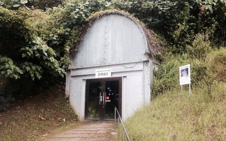
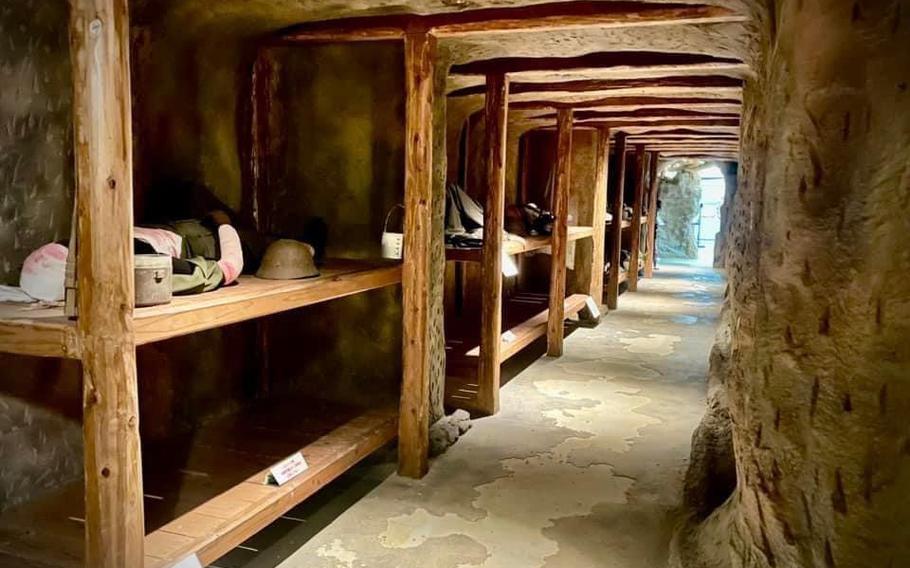
8. Okinawa Army Hospital
From Naha, head east for about five miles to the Okinawa Army Hospital. There is an underground tunnel used to treat wounded Japanese forces during the battle, according to a museum pamphlet.
Visitors are allowed to tour the tunnel, by reservation, where it still stands in present-day Kogane Forest in Haebaru. The Haebaru Cultural Center (museum) is also on the grounds of park and has various displays of artifacts, flags, clothing, and personal items relating to the history of the hospital. A life-size display of the tunnel with makeshift bunkbeds used when accommodating patients and hospital staff, can be walked through.
Kogane Forest Park also has a hill to hike, trails to follow, and signboards to read along the way (with Google Translate).
Okinawa Army Hospital (Photo by Steph Pawelski)
Okinawa Army Hospital (Photo by Steph Pawelski)
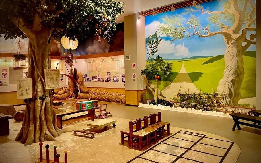
The museum features a child-friendly room with age-appropriate activities. (Photo by Steph Pawelski)
GPS (museum/parking): 26.1872465, 127.7307703
Hours: 9 a.m. – noon, 1 p.m. – 5 p.m.
*Closed on Wed. plus Dec. 29 – Jan. 3
For reservations, contact Haebaru Town Cultural Center (museum) at 098-889-7399 or H8897399@town.haebaru.okinawa.jp
*Reservation required for tunnel tours. The exhibition at the cultural center (museum) doesn’t require reservations. For tunnel tours, there is a 30-minute or one-hour course available. While the 30-minute course covers the tunnel only, the one-hour one covers surrounding areas as well. You will be accompanied by a tour guide on both courses. Each tour is limited to a group of eight or less.
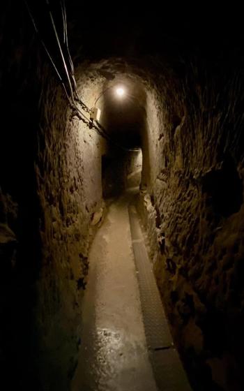
9. Former Japanese Naval Underground Headquarters
The Former Japanese Naval Underground Headquarters is in Tomigusuku and is a five-mile drive from the Haebaru Field Hospital. There is a visitor’s center and museum. Give yourself time to wander through the underground maze-like tunnels where Japanese navy personnel stayed and hid weapons and supplies during the battle.
Former Japanese Naval Underground Headquarters (Photo by Steph Pawelski)
Former Japanese Naval Underground Headquarters (Photo by Steph Pawelski)
GPS (headquarters and parking): 26.1863451, 127.6769247
10. Santenmo Park, Itoman
Next, you can head five miles south from the Japanese Naval Headquarters to Santenmo Park in Itoman. It is fun for the whole family! Even though it is an attractive park with a colorful playground, a signboard states that there are relics, located throughout the park, damaged by the United States military prior to the battle. There is an observation deck overlooking the Itoman Rotary. It is sometimes hard to develop a sense of how tragic the battle really was when an area is so beautifully maintained.
Santenmo Park, Itoman (Photo by Steph Pawelski)
Santenmo Park, Itoman (Photo by Steph Pawelski)
GPS (parking): 26.1302098, 127.6704951
GPS (park): 26.1299356, 127.6702543
11. Himeyuri Peace Museum
Go for a four-mile trip from Santenmo Park, through old Okinawa villages and the lush hills of Okinawa, to the Himeyuri Peace Museum. It is on the grounds of the former Ihara Third Clinic Cave. The cave was used as a field hospital to treat wounded Japanese soldiers throughout the battle, according to the Himeyuri Peace Museum.
As Lt. Gen. Ushijima began to realize the end of the battle was near, he ordered the end of the student corps and then committed suicide. Instead of negotiating with the Americans to protect the island’s civilians, these girls were left to fend for themselves.
Information at the museum indicates that over 100 of the original 222 nurses were killed after their corps were deactivated. The museum remembers the girls and teachers that were forced to become nurses. Photos of the nurses and written stories of their personal experiences during the battle are available to read (in Japanese). Interviews of some survivors are replayed to watch along with a life-size replica of the cave that can be walked through. Pictures, mannequins, and descriptions explain the nurses’ involvements throughout the battle and while working inside the cave.
The cave itself is off-limits.
Himeyuri Peace Museum (Photo by Steph Pawelski)
Himeyuri Peace Museum (Photo by Steph Pawelski)
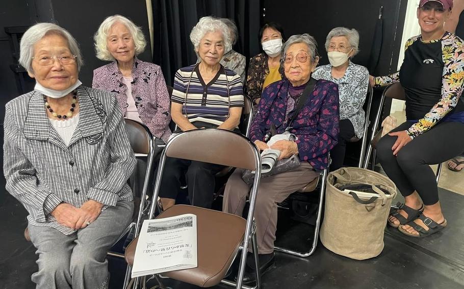
I had the honor of meeting seven Himeyuri student nurses that survived during the Battle of Okinawa. One nurse, Yasuko Onaga, 97, spoke about her experiences for an hour and a half and rarely hesitated, paused, or thought about what to say next. The session was almost finished, and she said she still had an hour left of things to say. (Photo by Steph Pawelski)
GPS (parking): 26.09608, 127.689909
GPS (museum): 26.0958909, 127.6907478
Hours: 9 a.m. – 5:25 p.m. (last admission at 5 p.m.)
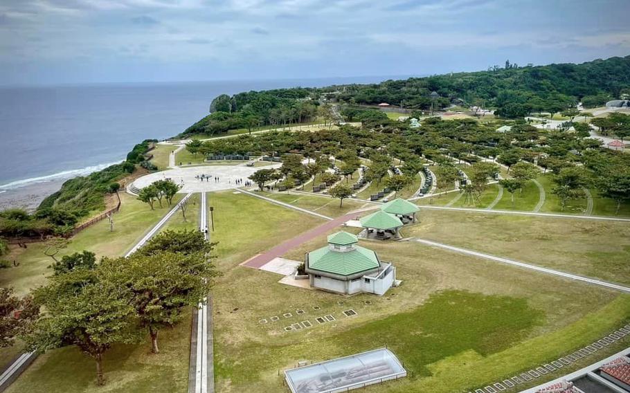
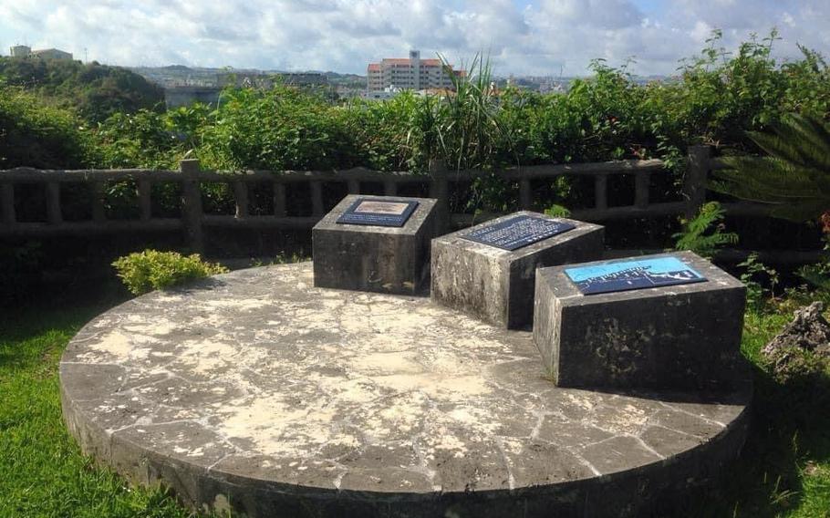
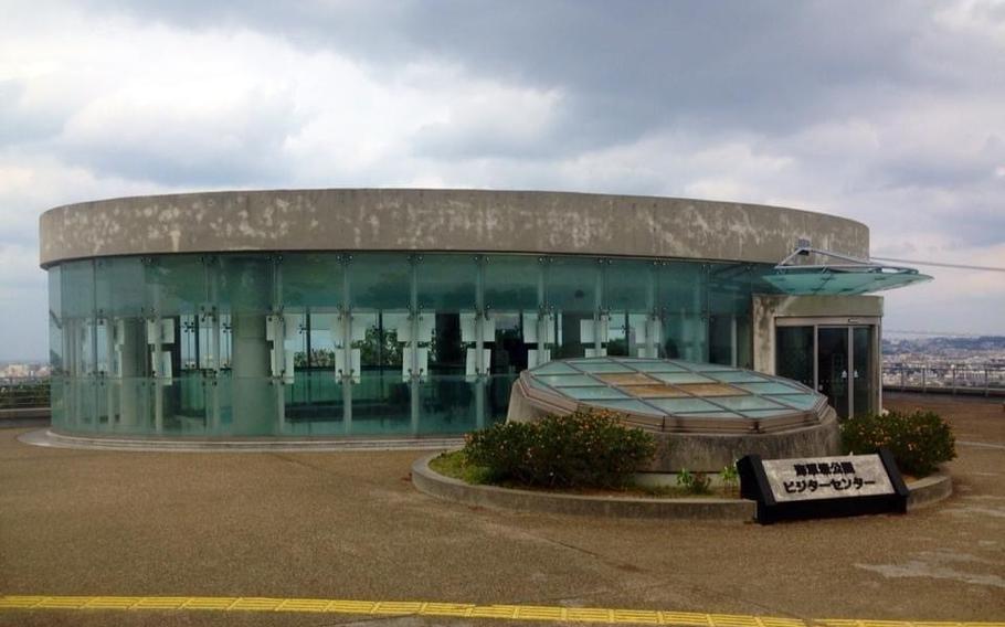
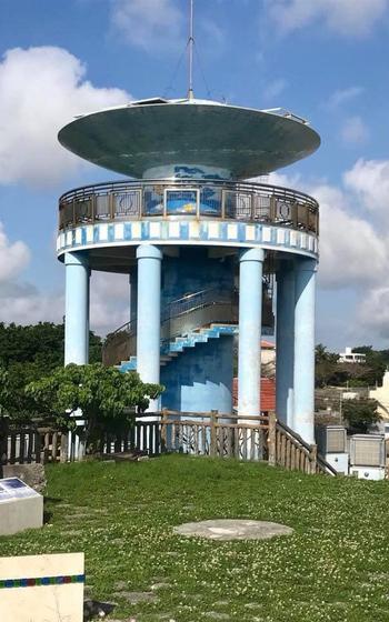
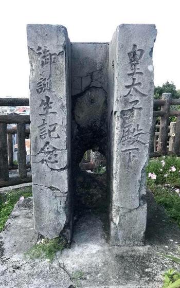
12. Okinawa Peace Memorial Park
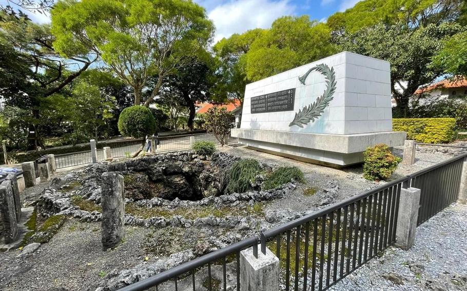
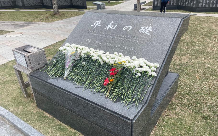
Finish your adventures two-and-a-half miles to the southern tip of Okinawa. Peace Memorial Park has many monuments and a museum relating to the Battle of Okinawa. The largest is Cornerstone of Peace, which is dedicated to those who perished during the battle. Their names are engraved into granite slabs placed on an open court, regardless of nationality and are positioned so the ray of the sun shines directly down the center on the morning of every June 23, the last day to the Battle of Okinawa. June 23 is known as War Memorial Day, or Irei-no-hi in Japanese, and is a public holiday on Okinawa.
Peace Memorial Park is one of the most beautiful parks on the island.
Okinawa Peace Memorial Park (Photo by Steph Pawelski)
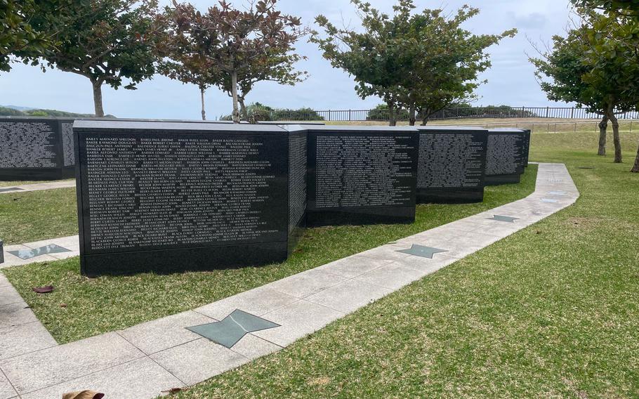
Granite Slabs at Cornerstone with the names of those who perished. (Photo by Steph Pawelski)
Okinawa Peace Memorial Park (Photo by Steph Pawelski)
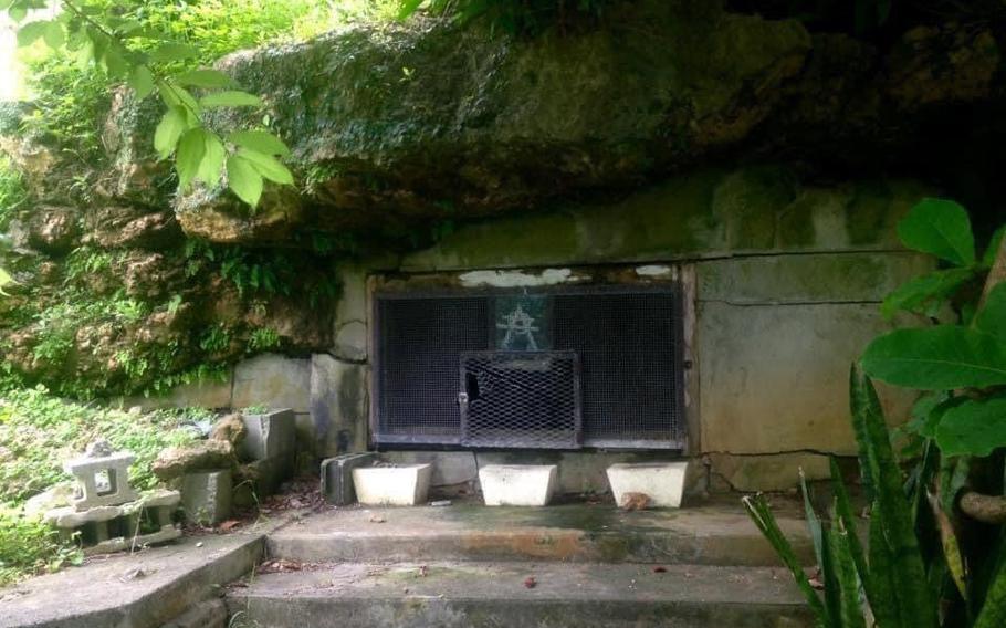
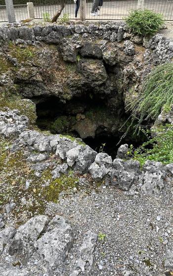
Final headquarters for the Japanese Imperial Army, where Lt. Gen. Ushijima and Gen. Cho committed seppuku. (Photo by Steph Pawelski)
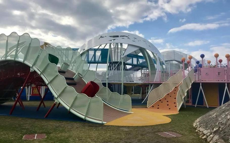
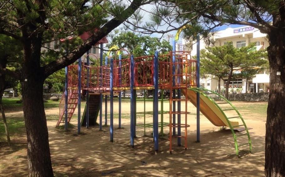
Kids playground at the Okinawa Peace Memorial Park. (Photo by Steph Pawelski)
GPS (parking): 26.0962507, 127.7221323
Peace Memorial Park Museum honors the Okinawan’s people and their experiences before, during, and after the battle and what life was/is like having their homeland being overshowed by two opposing military forces. There are exhibits with personal items including books, papers, diaries, and pictures.
GPS: 26.0962642, 127.7252765
Hours: 9 a.m. - 5 p.m. (last admission at 4:30 p.m.)
*Closed on Dec. 29 – Jan. 3
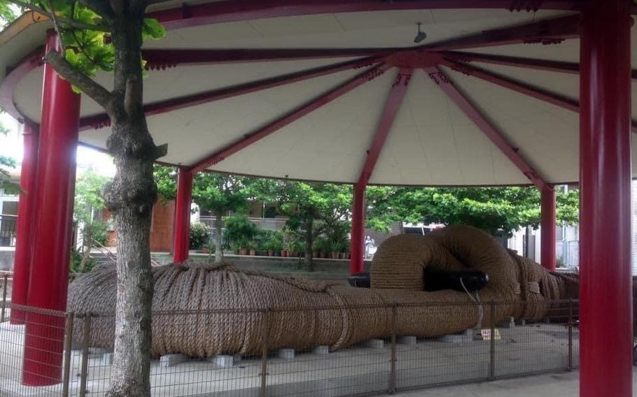
An air museum, outside of the Peace Memorial Park Museum, is on permanent display and includes numerous field artillery pieces from the Battle of Okinawa.
GPS: 26.0962907, 127.72566684
Peace Memorial Park has many monuments relating to the Battle of Okinawa. The largest is Cornerstone of Peace which is dedicated to those who perished during the battle. Their names are engraved into granite slabs placed on an open court, regardless of nationality and are positioned so the ray of the sun shines directly down the center on the morning of every June 23, the last day to the Battle of Okinawa. June 23 is known as War Memorial Day or Irei-no-hi, in Japanese, and is a public holiday on Okinawa.
GPS: 26.0951664, 127.7256896
The United States forces cornered the last of many Japanese soldiers and Okinawan civilians on the cliffs of Mabuni in the closing days to the Battle of Okinawa.
It was difficult for the Okinawans to believe the enemy would rescue them; instead, they threw themselves over the edge of these cliffs to their deaths.
GPS: 26.0951710, 127.7259226
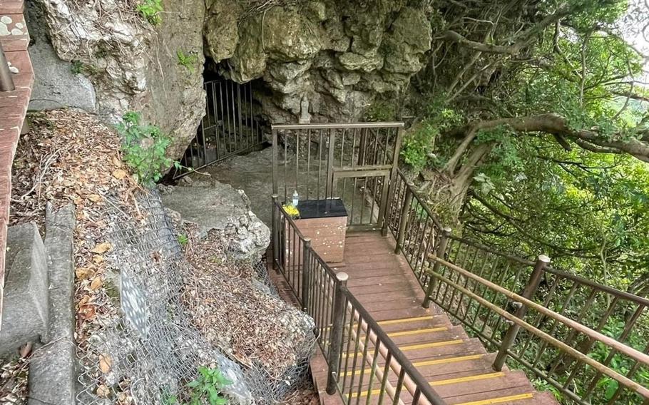
Mabuni Hill was the last of the 32nd Japanese Imperial Army Headquarters during the final days to the Battle of Okinawa. It was here that General Mitsuru Ushijima and Lieutenant General Isamu Cho committed hara-kiri. By the morning of June 22, 1945, organized resistance ended for the Japanese Imperial Army, Okinawa was captured, and an American flag was raised over the island.
GPS: 26.0927862, 127.7207107 (coordinates are for at the bottom of the stairs, follow the signs to the entrance of the tunnel)
For more on the battle sites in Okinawa, follow Okinawa Battle Sites on Facebook. The group was started by the author in 2021 to share information about the sites on Okinawa and her family’s adventures exploring them.
Stripes Okinawa writer Shoji Kudaka contributed to this story.