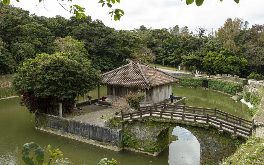
Enkanchi and Benzaitendo (Photo by Shoji Kudaka)
Though Shuri Castle may top your list among the many attractions to visit in Okinawa, the neighborhood surrounding the iconic castle is home to many other historical sites to check out.
Stop for a free tour at Zuisen Distillery, one of the few historical awamori distilleries dating back to Ryukyu Kingdom still in operation in the area.
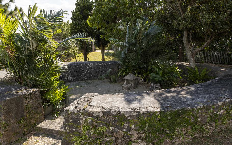
Check out Amagoi Utaki, Sakiyama Utaki and Sakiyama Heeja, important places of worship for the king back in Ryukyu.
Close by, Kinjo-cho Ishidatami Michi (stone-paved road) was once part of a road to mobilize military forces to defend what is now known as Naha Military Port. Here, five special, ancient Akagi trees (bischovia javanica) tower over the road at about 20 meters tall. Uchikanagusuku-utaki, another important Ryukyuan worship site, is also an attraction to visit.
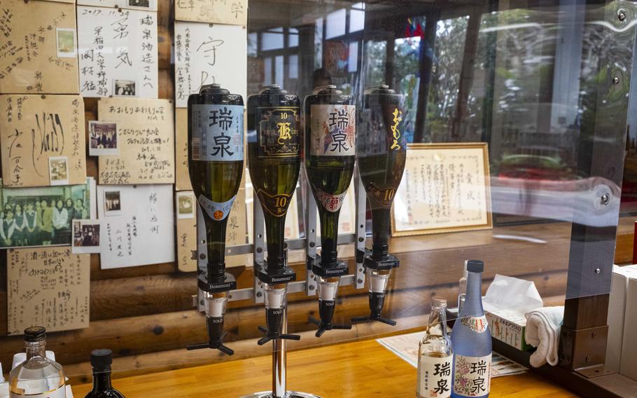
Zuisen Distillery (Photo by Shoji Kudaka)
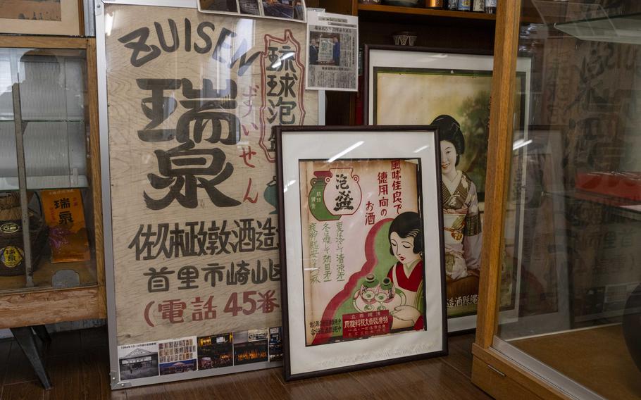
Zuisen Distillery (Photo by Shoji Kudaka)
Amagoi Utaki (Photo by Shoji Kudaka)
Sakiyama Utaki (Photo by Shoji Kudaka)
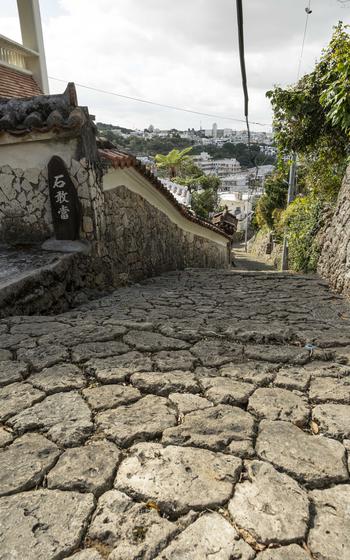
Kinjo-cho Ishidatami Michi (Photo by Shoji Kudaka)
Northwest of Shuri Castle, Ryutanike (Ryutan Pond) is a good place to stop for a relaxing break. The pond is shaped like a dragon’s head and was created during King Sho Hashi’s reign (1422 to 1439) as a sort of reflecting pool for Shuri Castle.
Southeast of Ryutanike, another pond, Enkanchi, was constructed in 1502 as a reservoir for a water source in Shuri Castle, according to the castle’s website.
Enkanchi and Ryutanike are connected by a water channel running under a stone bridge called Ryuen-kyo (Ryuen Bridge). If you cross the bridge and walk along the path, you’ll eventually reach a small islet where Benzaitendo, a small early-16th Century temple for storing Buddhist scripture, stands. From here, a stunning view of the temple above Tennyo-bashi bridge.
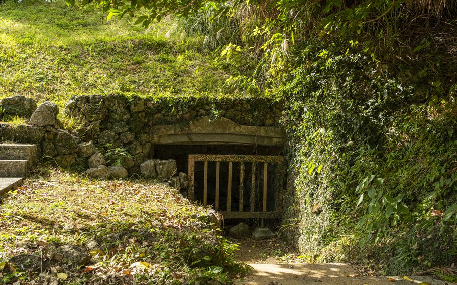
Near the south end of Ryutanike, is an entrance to a bunker which served as a stronghold for Japan’s Imperial Army during the Battle of Okinawa in 1945. A total of five tunnels are connected inside, running for about one kilometer under Shuri Castle. Access is blocked by a fence, but a description and a map of the tunnels are posted nearby, highlighting some of the history in the region during World War II.
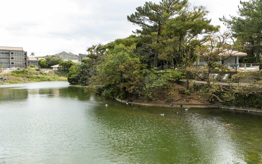
Ryutan Pond (Photo by Shoji Kudaka)
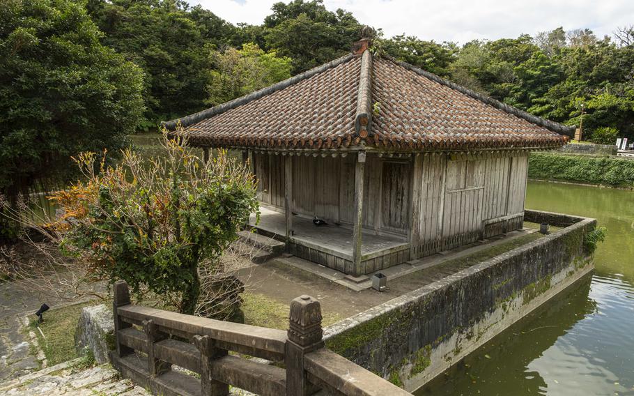
Benzaitendo (Photo by Shoji Kudaka)
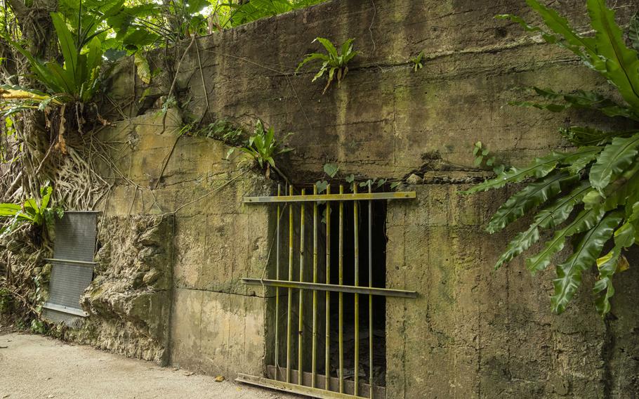
The 32nd Army Underground Headquarters Shelter (Photo by Shoji Kudaka)
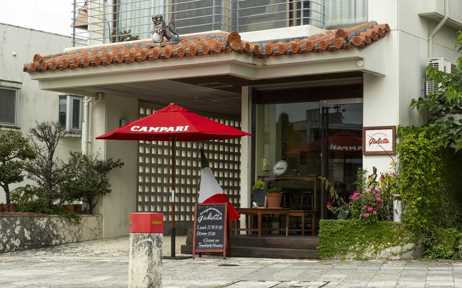
enogastronomia Giulietta (Photo by Shoji Kudaka)
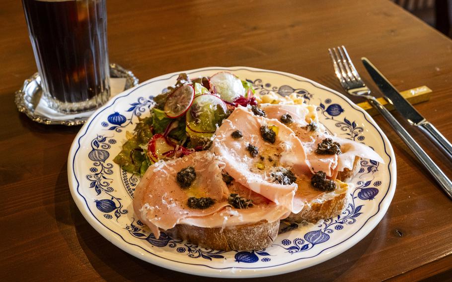
enogastronomia Giulietta (Photo by Shoji Kudaka)
Zuisen Distillery
GPS Coordinates: 26.21531, 127.72057
Hours: 9 a.m. – 5 p.m. Mon-Sat.
*Closed every 2nd and 4th Saturday of each month, Sundays, and Japanese national holidays.
*Reservation required for a tour.
For more info, check out the distillery’s website at https://www.zuisen.co.jp/english
Kinjo-cho stone paved road
GPS Coordinates: N 26.217130, E 127.716753 (North-end)
Akagi trees
GPS Coordinates: N 26.215875, E 127.716014
enogastronomia Giulietta
GPS Coordinates: 26.22053, 127.71694
Hours: 11:30 a.m. -2 p.m. (lunch), 5 – 9 p.m. (Dinner), Tues. – Sat., Closed on Sun. and Mon.
*Prices and menu items are subject to change.
Ryutanike / Ryutan Pond
GPS Coordinates: 26.220153, 127.716692 (west end)
Enkanchi and Benzaitendo
GPS Coordinates: 26.21842, 127.71858
The 32nd Army Underground Headquarters Shelter
GPS Coordinates: 26.218414, 127.717677
*For regular-sized cars, Shuri Castle’s parking lot costs 400 yen for the first hour, 200 yen per 30 minutes after that. The maximum fee is capped at 800. There are many coin-parking around the area as well. Prepare a designated driver if you are planning on sampling Awamori at Zuisen.