(Photo by Shoji Kudaka)
On a sunny late-autumn day, I headed to Horohoro no Mori in Yaese Town on Okinawa’s southern coast. Horohoro no Mori’s name describes it as a forest of Cinnamomum, fragrant trees you’ll find plenty of here.
Traveling from the mid-section of the island to Horohoro no Mori was about a 1-hour drive. Seeking an adventure among the greenery and flowers along the southern coast, it wasn’t a problem to make the drive.
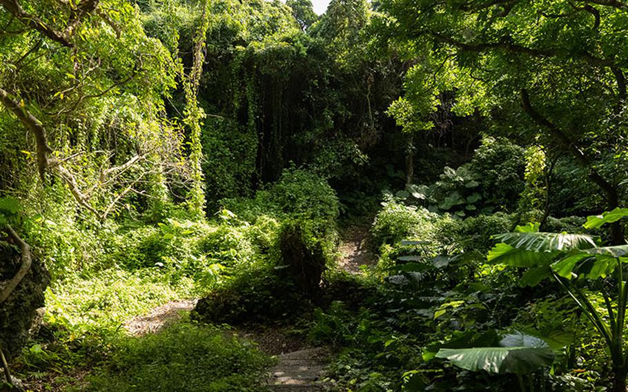
At the entrance of the fragrant Cinnamomum forest, a map illustrated the winding 600-meter route I had ahead. The first portion of the hike included many steep ups and downs, but the wooden steps made this part easier to manage.
Deep in the forest, I encountered taro trees with unusually large leaves, banyan trees and akou (Ficus superba) tangled with rocks like creatures in motion. Eventually, I reached the Gushichan-hama Beach, known for its many reef lagoons and large rocks dotting the coastline. Although its sandy shore may not be wide, the beach still dazzles tourists and locals with its unique landscape.
Before ending my day, I made sure to make a couple of stops at some of the other attractions in the area, including a limestone bridge and castle ruins.
Although it may take a little longer of a drive than usual from many of the military installations on Okinawa, this area definitely makes for a great day trip. Check it out!
Horohoro no Mori (forest) GPS Coordinates: N 26.118886, E 127.744157
Gushichan-hama (beach) GPS Coordinates: N 26.118876, E 127.747665 *Parking space available for free.
Hanandaa (limestone bridge) GPS Coordinates: N 26.120663, E 127.744036
Gushichan Castle Ruins GPS Coordinates: N 26.121393, E 127.749998 Parking space is available for free.